


Electric Transmission Structure Risk Analysis
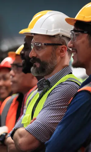
Electric Transmission Structure Risk Analysis Upper Midwest About the Project Basin Electric fills a critical role as an energy provider in the upper Midwest. There are many challenges associated with maintaining over 3,400 miles of transmission lines and over 16,000 structures spanning seven states. Basin Electric has witnessed a change in the soil stability and […]
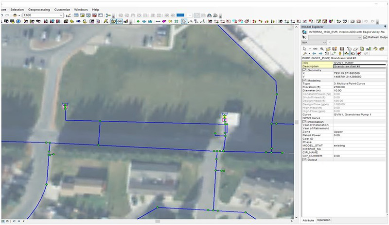
Eagle River Water and Sanitation District Modeling, Master Planning, & CIP
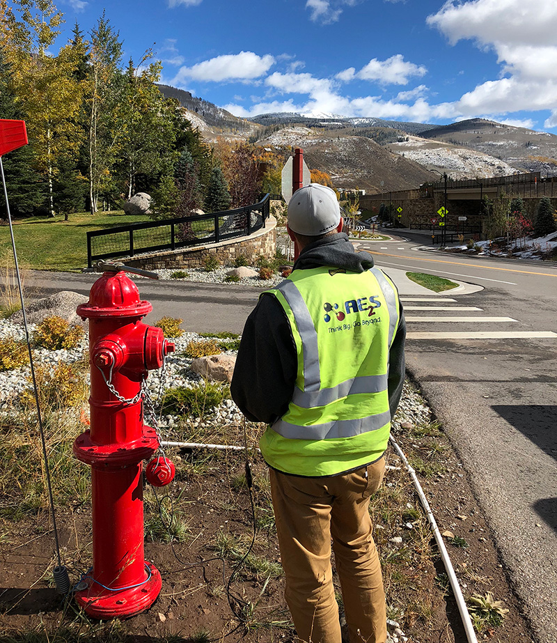
MODELING, MASTER PLANNING, & CIP Vail, Colorado About the Project Eagle River Water & Sanitation District (ERWSD) serves multiple municipalities (East Vail, West Vail, Avon, Cordillera, Wolcott, Edwards, Eagle-Vail, Berry Creek, Beaver Creek, Arrowhead, etc.), and is the second largest utility on the western slope of Colorado. Surges in population, tourism, and business have caused […]
Western Area Water Supply Project Geographic Information System
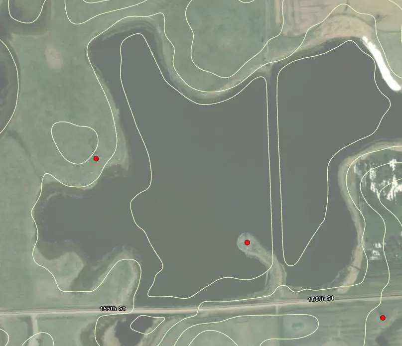
GEOGRAPHIC INFORMATION SYSTEM Western North Dakota About the Project The oil boom in northwestern North Dakota created a frenzy of industrial activity and economic development. The area’s infrastructure, however, was not adequate to handle this extreme growth. The Western Area Water Supply Project (WAWSP) was developed to create a regional water system to supply drinking […]
Helping Brandon Using GIS to Identify Storm Drainage Needs
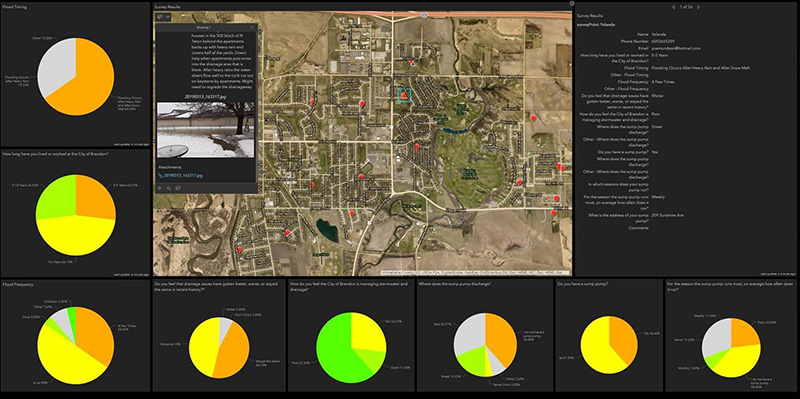
USING GIS TO IDENTIFY STORM DRAINAGE NEEDS Brandon, South Dakota About the Project The City of Brandon is a growing community in southeastern South Dakota. Like other communities, Brandon is facing the challenge of providing new infrastructure to support growth, while also maintaining its existing systems. In 2019, the City determined that an overall plan […]
GIS for Fargo-Moorhead Metropolitan Area Flood Diversion Project
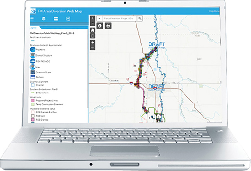
GIS FOR FARGO-MOORHEAD METROPOLITAN AREA FLOOD DIVERSION PROJECT Cass County, North Dakota About the Project The Diversion Authority, made of up of stakeholder entities in the Fargo and Moorhead area, is working on permanent flood protection for the community. The FM Area Diversion Project will protect the community from a catastrophic flood event and prevent […]
Kalispell GIS and Water Modeling Integration
GIS AND WATER MODELING INTEGRATION Kalispell, Montana About the Project In 2017, AE2S was tasked with providing services to the City of Kalispell to review the status of the water system, adjust planning criteria, identify current and future challenges, and to develop a Capital Improvement Plan (CIP), which will ensure the City will be able […]
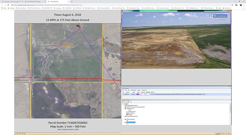
Williston GIS Improvements
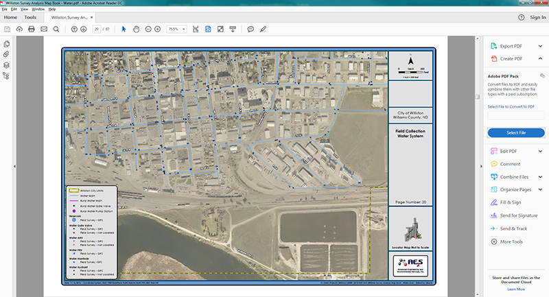
GIS IMPROVEMENTS Williston, North Dakota About the Project The City of Williston worked to develop, implement, and establish a long-term preventative and condition-based maintenance program for equipment and infrastructure assets within the Public Works, Wastewater, Water, and Engineering Departments. The City’s goal was to implement a Computerized Maintenance Management System (CMMS) to provide a GIS-centric […]
Williston GIS Needs Assessment
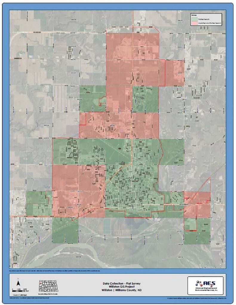
GIS NEEDS ASSESSMENT Williston, North Dakota About the Project The City of Williston has been experiencing rapid growth, creating increased pressure to manage and maintain its ever-changing infrastructure. To help with this the City decided to implement a Computer Maintenance and Management System (CMMS) through Lucity. GIS is vital to the use of CMMS for […]
GIS for Red River Valley Water Supply Project
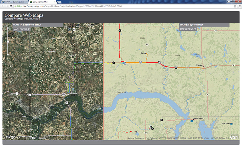
GIS FOR RED RIVER VALLEY WATER SUPPLY PROJECT Central and Eastern North Dakota About the Project The Red River Valley Water Supply Project is a plan to safeguard water for North Dakota communities and rural water systems in times of drought by delivering water from the Missouri River to central and eastern North Dakota through […]
Eagan Long-Term Planning System Renewal Planning
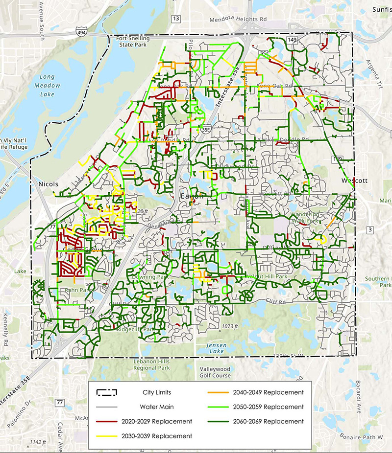
LONG-TERM PLANNING SYSTEM RENEWAL PLANNING Eagan, Minnesota Flexible and Adaptive Modeling to Ensure Future Capital Improvements are Adequately Funded The City of Eagan experienced rapid growth in the late 70s and early 80s, which resulted in much of the City’s infrastructure being installed within a single decade. For years, there was minimal need for capital […]