USING GIS TO IDENTIFY STORM DRAINAGE NEEDS
Brandon, South DakotaAbout the Project
The City of Brandon is a growing community in southeastern South Dakota. Like other communities, Brandon is facing the challenge of providing new infrastructure to support growth, while also maintaining its existing systems.In 2019, the City determined that an overall plan for the storm drainage system was needed to identify problem areas and develop appropriate solutions.
Project Details
Date: 2019
Client: City of Brandon
Key Project Elements
- Combination of GIS and Crowdsourcing
- Public Engagement
Identifying and Addressing Drainage Issues
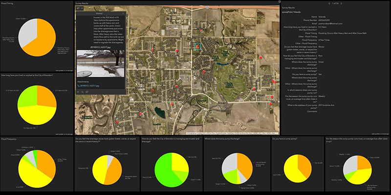
An initial step in the process included a public outreach effort to solicit input from the community to identify problem areas. In particular, the City was interested in using GIS technology to give citizens the ability to both pinpoint problem areas on a map, and provide written descriptions of the problem.AE2S implemented GIS tools (Survey123, Crowdsource Reporter, and Operations Dashboard) as part of a community survey. The survey included a set of key questions related to drainage issues, while also capturing location information useful in identifying trends and confirming assumptions about potential problem areas.
GIS-Driven Prioritization of Capital Improvements for Storm Drainage Solutions
With the community’s input, the City was able to develop a list of specific drainage problems which resulted in a series of prioritized capital improvements to address the problems.The use of GIS and crowdsourcing tools has enhanced the City’s commitment to public engagement while also helping City staff develop a list of strategic capital improvements to improve the City’s storm drainage system.