


GIS FOR RED RIVER VALLEY WATER SUPPLY PROJECT
Central and Eastern North DakotaAbout the Project
The Red River Valley Water Supply Project is a plan to safeguard water for North Dakota communities and rural water systems in times of drought by delivering water from the Missouri River to central and eastern North Dakota through a buried pipeline.Upon its completion, the RRVWSP will benefit about half of North Dakota’s population by providing a supplemental water supply during droughts.
Project Details
Date: 2008 – Present
Client: Garrison Diversion Conservancy District
Key Project Elements
- GIS
- Multiple Counties
- Drone Data Collection
- Video Documentation
Efficient Parcel Mapping and Drone Utilization for Streamlined Project Tracking
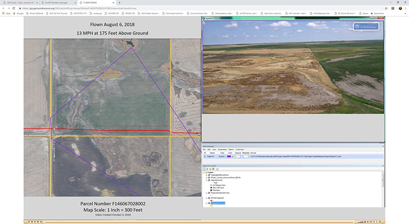
The RRVWSP will span about 150 miles through six counties. The GIS team has mapped each parcel along the route so that information about access, surveys, and easement acquisition can be collected and tracked using a workflow manager.Using data from drones has been an integral part of the project. The entire project team, from project manager to land agent, has access to map-linked oblique view drone videos for each of the parcels along the route for preconstruction documentation and to see ground conditions, potential hazards, and environmental features to make decisions.
AE2S has the expertise to capture high resolution drone video, process it, and deliver the map-linked videos in an accessible format.
Tagged Regional/Rural Water