


FM DIVERSION LAND MANAGEMENT/ACQUISITION
Fargo, North Dakota
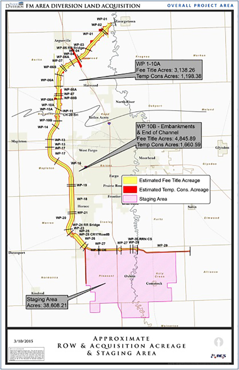
The proposed Fargo-Moorhead Area Diversion Project consists of the construction of a 30-mile long diversion channel, a 20-mile long embankment, and a variety of associated infrastructure located in North Dakota and Minnesota.
The Project will divert flood water around the Fargo-Moorhead metropolitan area.
The Land Acquisition portion of the project includes acquiring property rights (either fee title transfer or various easement agreements) on thousands of parcels of land in 17 different townships and a total of 137 different sections.
The project crosses the six rivers including the Red, Sheyenne, Wild Rice, Maple, Rush, and Lower Rush Rivers, and also contains three interstate highway crossings and numerous state and county highway and railroad crossings.
Project Details
Date: 2013 – 2015
Client: Cass County Joint Water Resources District
Key Project Elements
- Includes Acquiring Thousands of Parcels of Land
- 17 Different Townships
- 137 Different Sections
- Acquire Land According to Federal Acquisition Procedures
AE2S Responsibilities
AE2S’s responsibilities for the Project range from managing the land acquisition process to producing Certificates of Survey and plats of new parcel boundaries and everything in between.One of the key services provided by AE2S is conducting boundary surveys to subdivide properties and produce new parcel and easement legal descriptions.
AE2S is responsible for conducting boundary surveys to support the acquisition of about 7,100 acres of fee title parcels and nearly 2,000 acres of temporary construction easement (TCE) obtainment distributed throughout 300+ current parcels.
In addition, AE2S is responsible for any surveying needs for flowage easements on approximately 7,000 acres of land in Minnesota, and 190 parcels along the Red River, Buffalo River, and Wolverton Creek for environmental monitoring easements.
The survey of the parcels impacted by the ¼-mile wide diversion channel includes the breakdown of 52 sections in nine townships, as well as Interstate Highway 29, ND State Highway 81, and BNSF Railroad right-of-way surveys.
The channel route also contains boundaries along the Red and Sheyenne Rivers and crossings at the Rush, Lower Rush, Maple, and Sheyenne Rivers.
The boundary surveys will produce Certificates of Survey and plats with nearly 1,000 new legal descriptions for the subdivided parcels and easements, making AE2S a key contributor to the land acquisition and surveying process.