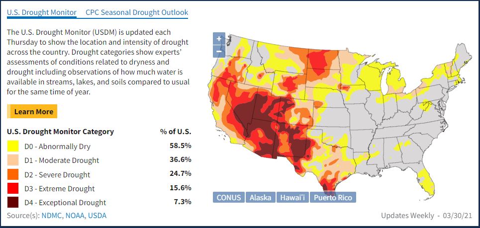
The National Oceanic Atmospheric Administration (NOAA) has updated the drought.gov website to include information that will be useful to utilities. NOAA’s National Integrated Drought Information System (NIDIS) program now compiles information about streamflow, snowpack, snow drought (abnormally low snowpack), and precipitation outlooks.
NIDIS allows users to look at current and historical data from across the United States, down to the ZIP code. The site offers maps with the latest streamflow overlaid on top of the drought monitor, snow-water equivalent, and precipitation outlooks are especially useful for utilities.
Here are links to relevant information on the site:
- Outlooks and Forecasts — Maps and links for precipitation, temperature, evaporative demand, drought, flash drought and soil moisture.
- Snow Drought — Tools for accessing snow data, including snow and river conditions, freezing levels, ice cover and more, particularly important to Western water utilities.
- Water Supply Research and Resources — Tools to monitor hydrologic drought.
- National Current Conditions — A weekly narrative of how drought is affecting the nation.