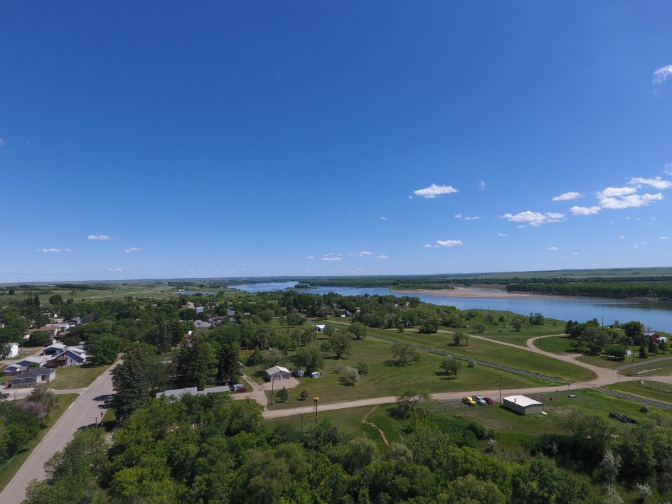
Early in the spring of 2018, a team of people at AE2S Communications was trying to find ways to explain the complexities of a wastewater system on the verge of a necessary upgrade. In addition to system age, population growth and other issues, the wastewater system faced water pressure issues from users located more than 4,000 vertical feet apart.
In the end, the best and most effective answer included a drone. While engineers worked on technical aspects, the communications team created a series of videos explaining the system and provided a bird’s eye view of the nearby ski resort to emphasize just how much height and pressure make the Big Sky Water and Sewer Users District unique.
This is one of multiple conversations that happened across tables at AE2S in 2018. A complex problem presents itself, and the simple answer has four propellers and a remote control – a drone.
Project managers needed to know what farmland looked like before construction crews moved through and installed pipeline for a water system expansion project in rural Walsh County, ND. The answer: fly a drone down the pipeline route to get a high-quality video of the parcels before the construction activity begins.
Engineers working on site in South Dakota needed to understand the layout of a piece of property when designing a subdivision. They also needed new topographic data and updated aerial imagery. The answer: fly over the property and create a 3D map with an up-to-date aerial photo for designers and decision makers to use.
On a multi-county water infrastructure project in central ND, Surveyors and GIS mapping technicians needed to link existing conditions of parcels to a geographic location in order to help connect the design team, landowners, and construction crews. The answer: fly the project alignment with a drone and create a tool to allow the client to see the videos directly through their GIS platform.
Time is of the essence when surveying work stockpiles, and the rugged, inconsistent nature of stockpiles makes them difficult to precisely survey with traditional equipment. Drones cut that time by at least half and often deliver results with higher levels of accuracy. Plus, with a drone, the surveyor does not have to set foot on the pile, which makes it is a much safer process than traditional surveying.
Across every geography in which AE2S works, remote pilots in command were busy providing answers from the sky.
“We have a handful of pilots who were really busy this summer,” Nick Stattelman, PLS, PE, Survey Practice Leaderand Licensed Remote Pilot, said. “We used drones for surveying, 3D mapping, GIS integration, oblique view videos and communication videos as well. Every client needs something different, but we used drones effectively to help provide a lot of quality answers this year.”
Although many people have drones and fly as amateur pilots, the rules governing commercial flights are strict and clear. Flights for anything other than “personal pleasure” must be done by a registered Remote Pilot In Command. To become a Remote Pilot, you must pass a test and register with the FAA every two years.
“We really focus on making every single flight efficient and safe,” Stattelman said. “Flying drones is not just about having the certification, this is about safety and getting the highest quality data, video and photos we possibly can.”
AE2S has been working with Unmanned Aerial Systems (UAS), or drones, for more than two years.
“We first started using them to gather construction videos,” Communications Specialist Tammy Jo Anderson Taft said. “Flying was brand new for me when I started researching the UAS laws and took the Remote Pilot Certification test. Now we fly on a regular basis for a few different clients and it really gives their videos, photos and everything we make a new angle.”
From Minnesota to Montana and South Dakota to all four corners of North Dakota, the pilot corps at AE2S has been working on plans to help incorporate drone technology into even more projects in 2019.
“There are so many things we can help clients with using this technology,” Stattelman said. “We know there is a lot of value in being a step ahead in how to use drones to supplement and enhance the services we provide.”